READ THE FULL STORY
How can your organization duplicate these incredible results?
Get details on how Dubuque County:
- accomplished its goals
- saved thousands of dollars
- reinvested in education by partnering with UScellular for wireless solutions.
New Portal Leverages GPS and Cellular Technology
In November 2021, Dubuque County launched an online portal that provides 24/7 access to treacherous road conditions and helps residents plan safer routes to work and school.
The new portal displays snowplow locations, indicates already-plowed roads, and provides dashcam images, local weather radar and road closure announcements to help users plan their journey.
“The most critical value is providing information to the public, letting them know there is important life safety work being done during snow events,” said Nathan Gilmore, Dubuque County IT director. “The public can use that to make decisions about whether they go out of the house. We have almost 880 miles of county roads. Getting that information to the public in a real-time manner is incredibly helpful from ours and the public’s point of view.”
In the first three months since launch, Dubuque’s web portal has already attracted thousands of users, who now have access day or night to real-time road conditions.
Public Demand for Information
Before the new portal was launched, Gilmore said the public would call the Roads Department to ask, “When is my road going to be plowed?” Or they would call to complain that they had not been plowed.
During a snowstorm, there was no one to answer calls after hours. “They’re off plowing snow,” he said. But residents who worked graveyard shifts needed to know which roads had been plowed so they could make safer travel decisions. “There might be five different ways for them to get to work at 2:00 am. One of those routes is fully plowed, the other four are not.”
There was also a demand for information from schools, he said. Superintendents needed road conditions so they could determine if they were going to call off school in the morning.
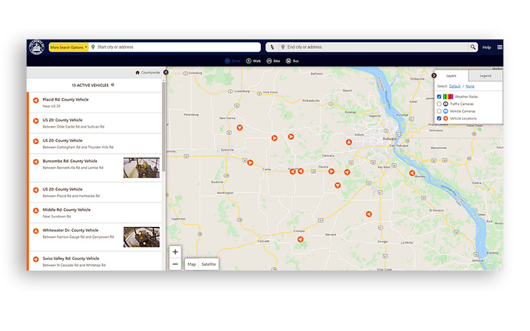
The portal shows plow locations and dashcam images.
Finding the Right Solution
Gilmore said the county could not provide the information requested using their older GPS system, which didn’t offer a publicly viewable portal or provide essential data. “We couldn’t even fake it with the previous system, so the first phase of this was, let’s get a system in place that will work for our needs and is reliable.”
He began evaluating options and chose a solution powered by an Internet of Things (IoT) data network that links vehicles equipped with Cypress VUE GPS tracking software and a modem with SIM card for cellular connectivity. The Iowa Department of Transportation (DoT) had already vetted and chosen this GPS solution. “We’re not going to reinvent the wheel. And there are synergies in being on the same system as the state.”
Dubuque County has had longtime relationships with UScellular, including accounts with the Sheriff’s office, Elections, Library, Roads and Health departments, each with hotspots and smartphones. So, when it was time to connect their new GPS solution to transmit data, they looked to a known and trusted entity.
“I needed a company that had good coverage. But that was secondary to an actual partner,” Gilmore said.
“It was important to make sure that we had good coverage, because obviously our vehicles have to cover the whole county. We tried different cellular companies and UScellular had the best coverage,” said Darren McCarthy, network administrator and technical lead on the project for Dubuque County.
McCarthy added that UScellular service has been “spot on,” even in the most remote areas of the county where it’s otherwise difficult to get a cellular connection.
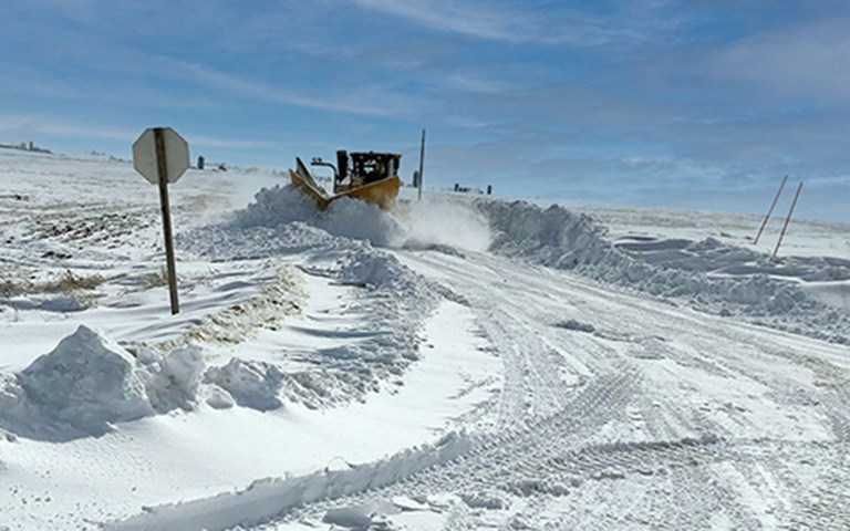
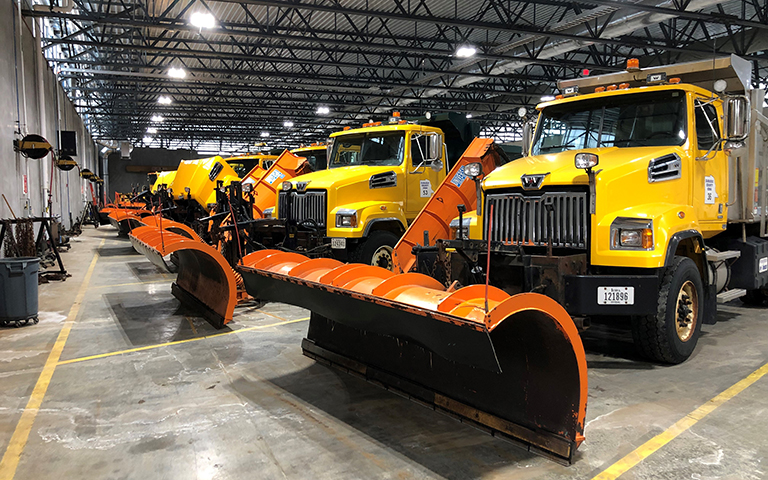
Dubuque County has more than 880 miles of roads to plow.
Improving Customer Interactions
Following a pilot in 2020, Dubuque County launched its online GPS tracking portal in mid-November 2021. With the new system, the public can still call a Roads representative. “But now that we have the online portal, the public can just go straight there, so I suspect there will be far fewer calls, because why would you call if you can just look at the map?” said Gilmore.
The GPS tracker installed on each of the county’s snowplows connects via UScellular’s network and transmits information to the public-facing portal.
Dubuque County will be working with UScellular on future capabilities, including perhaps posting road closure notifications and displaying electronic signs that users can read on the portal.
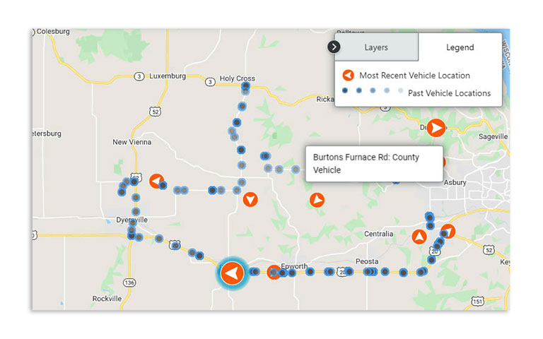
An orange circle with arrow indicates current truck location and direction, and blue dots identify areas already plowed.
The UScellular® Difference
The GPS tracker could operate on most mobile networks, but Dubuque County chose UScellular to provide connectivity.
“I’ve worked with other carriers, but what differentiates UScellular is its customer service and the ability to help me get something done quickly. They don’t make me jump through 100,000 hoops or send me to voicemail or ignore me. There’s no comparison between UScellular and the other providers, and that’s my first-hand experience working with them over the last seven years,” Gilmore said.
UScellular has delivered for his team in the past and Gilmore spoke highly of his experiences. For example, the county’s elections equipment connects via UScellular and performed flawlessly during past elections. “That was a phenomenal experience to get those set up, to activate them, deactivate them, working through any challenges. UScellular was fantastic and continues to be fantastic,” he said.
“My rolodex has professionals and partners and people that I can call and trust to help me solve problems and I would put UScellular in that Rolodex.”
Benefit-Rich Results
Benefits of the solution go beyond public dissemination of information. Gilmore said the county engineer and his team use data from the vehicles to make operations decisions and learn more about vehicle and driver requirements.
“They can set alerts to see why is it that on Sundown Road when John is going up this particular stretch, the RPMs peak to the red line. That’s all data that’s being gathered now and being ingested, and we have reports. And you know, maybe it’s because he’s flooring it up a hill. Or maybe he’s pulling something. Or maybe the truck needs work,” he said.
The system can also provide potentially life-saving data for what McCarthy deemed “a very dangerous job. You’re plowing the side of a road and might get blown into the ditch—we have trucks that are rolled over.” In emergencies, the dispatcher can use the tracking system to identify and locate a stopped vehicle in which the driver is not responding, he said.
In addition, the system can better monitor salt usage to help reduce costs. For example, the Roads Department will know that a driver used 22 tons of salt on his route during a snow event. “That’s an actual number they can track, whereas before they were just using a bulldozer to load and track it,” Gilmore said. When ordering salt for next season, the Roads Department can also read historical data when purchasing materials.
“There is a human factor too. There’s somebody at a keyboard or a mobile phone using this system to make a decision. There’s somebody out on a road using this real time or in their living room deciding, well, should I delay going to work? And I think that’s a pretty good deliverable for this very first step,” he said.


